Maine River Herring Network
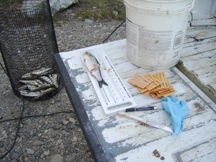
 Image of a river herring sitting on a measuring plate, surrounded by a bucket, pen, data tags, and a butter knife. In the background is a basket of herring. Photo credit - Baliey Bowden.
Project Introduction
River herring and shad (RH/S) are monitored by different entities coastwide, and it is challenging to get a big-picture perspective on the strength and trends of the population coastwide. Counts of returning adults are often collected by volunteer groups, NGOs, or state agencies, and there is no coast-wide platform (or even state-wide platforms, in most cases) to share that count data more broadly. This makes it difficult for communities who are invested in monitoring and stewarding these runs to get a sense for how their efforts fit into the larger scope of RH/S along the east coast. This is made more difficult by the infrequency of RH/S stock assessments. The idea of a single portal where all (or most) east coast RH/S run data could be visualized arose in early discussions at NOAA’s River Herring Technical Expert Working Group (now the Atlantic Coast River Herring Collaborative Forum).
In this project, students will work in collaboration with community partners from Manomet and the Maine Center for Coastal Fisheries to update the Shad/River Herring Run Data Portal to gather and display information about river herring daily run counts and adding relevant environmental data (e.g. stream flow, precipitation, and temperature). Since 2020, Manomet and Maine Center for Coastal Fisheries (MCCF) have been co-facilitating the Gulf of Maine River Herring Network, which brings together diverse stakeholders working to support river herring restoration, research, and management in the Gulf of Maine. The purpose of the RShiny platform is to summarize and visualize trends across the range. The primary purposes of this platform is to serve as a communications tool to build a greater shared understanding of the status of river herring state-wide, and to provide managers with an annual view of the status of the stock in between regular stock assessments. As part of the project, students will also refine and test out existing forms where users are able to upload annual river herring counts after spring run. Students may also engage in compiling information about local stewards and stewardship, whether a run is harvested, and seeking ways to incorporate that data in the platform.
Background on River Herring
The term “river herring” refers to two species of anadromous herring: alewives (Alosa pseudoharengus) and blueback herring (Alosa aestivalis). Because they are anadromous, they leave their saltwater habitats every spring to swim upriver to spawn, posing unique management considerations. These species are present all along the east coast of North America, from Canada to Florida.
River herring play a critical role in freshwater and marine ecosystems and are economically and culturally important to many Maine coastal communities. They are typically harvested by net, and are used for bait, primarily for the lobstering industry, or eaten smoked.
Maine’s fishery is unique in a handful of ways: first, it is one of the only prominent commercial harvests of river herring on the east coast. Second, in Maine the State delegates harvest authority and some management/monitoring responsibilities to municipalities. In order for a municipality to gain and retain their commercial harvest privileges, they must continuously monitor the fish populations in their runs. There are a wide variety of techniques to do this: some communities have fish ladders with gates that allow them to get an absolute count (they count every fish that goes up the ladder) and others count periodically, extrapolating that count over time to create an estimate. Some municipalities have used underwater cameras and counted fish in the footage. Others use automatic counters that detect fish when they move through a gate.
This municipal engagement is often cited as a strong incentive for conservation and management, and helps the municipalities and harvesters to decide how many days the fishery should be open and to whom. Using Maine as a case study we will begin to incorporate stream and other environmental data into the data platform.
Skills you can expect to gain
Skills students can expect to learn:
- Development of an R Shiny App that allows river herring counts to be downloaded and visualized.
- Write code to display runs by an individual state from the app.
- Development of database to store river herring count (and other kinds of monitoring–temperature, flow, tide) data.
- Creation of testing scripts to identify quality control issues.
- Development of clear protocols for metadata and data upload.
- If time permits there may be an opportunity to contribute to designing a survey for community stewards and to participation in outreach to organizations and groups collecting river herring count data across the East Coast to understand counting methods (visual, electronic, video) and data format, and inform development of the data platform.
Resources:
- The River Herring Network
- Maine DMR’s Sea Run Fisheries Page
- Student Project on River Herring Co-management
- A Watershed Moment—Film About River Herring Restoration on the Bagaduce
For historical context on the river herring fishery see
- Downeast Fisheries Trail website’s Fisheries Then — by Natalie Springuel and Julia Beaty
- Fisheries Now — by Julia Beaty.
For more COA adventures with River Herring see articles by past COA studens Emma Ober; Katie Clark, Melisa Chan, and Meret Jucker; Savannah Bryant and Emma Kimball; and videos by Annaleena Vaher.
Acknowledgments
Special thanks to Sophie Chivers ‘24 for creating the project description and for finding, preparing and creating initial visualizations of the environmental data. Special thanks to Delphine Demaisy ‘26 for creating the tutorial combining tide and temperature data and to Shea Turner-Matthews ‘26 and Emily Rose Stringer ‘24 for creating the beta version of the River Herring and Shad Data Portal.